GATE 2017 EC (EC2) – Question 10
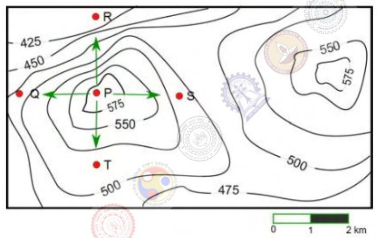
A contour line joins locations having the same height above mean sea level. The geographical contour plot shown has contours at 25 m intervals. Which is the steepest path leaving P?
Practise this question in The GATE Grind →
Show answer and explanation
Correct answer: (B) P to R
Explanation
Slope magnitude is elevation change divided by horizontal distance. Because the contours differ by the same 25 m increment, more tightly spaced crossings indicate a steeper slope.
Compare the four marked paths using the map scale and the intervening contour crossings. Toward R, the contours are closest and the same elevation loss occurs over the shortest corresponding horizontal distance.
Thus **P to R, B**, is the steepest marked path. The absolute elevation at P alone does not determine the slope.
More Spatial Aptitude: Spatial Reasoning and Visualization questions
- GATE 2017 EE (EE2) Q10
- GATE 2021 XH2 Q2
- GATE 2021 XH2 Q7
- GATE 2021 XH5 Q2
- GATE 2021 XH5 Q7
- GATE 2026 MN Q2
All Spatial Aptitude: Spatial Reasoning and Visualization questions →