GATE 2017 CS (CS1) – Question 10
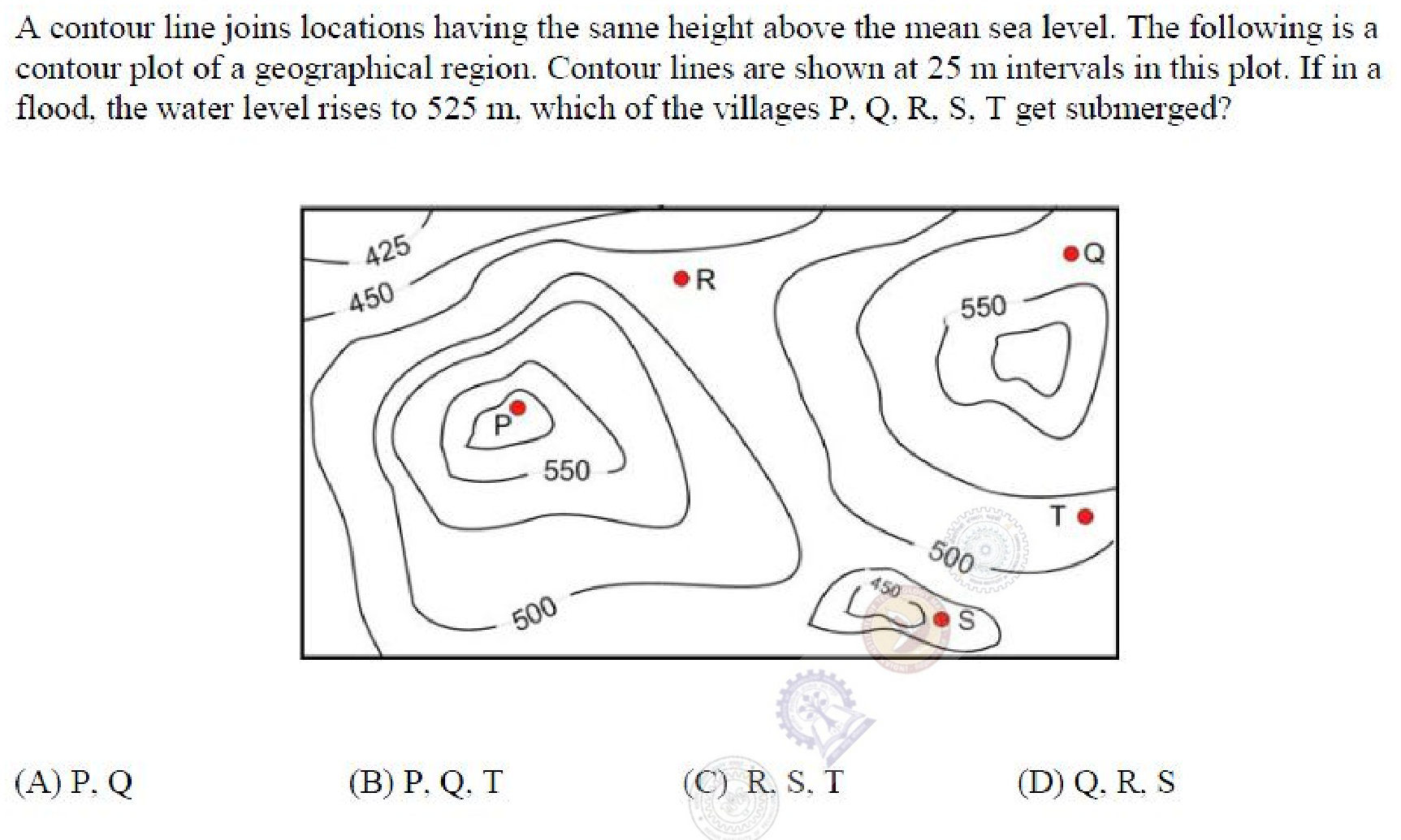
A contour line joins locations having the same height above the mean sea level. The following is a contour plot of a geographical region. Contour lines are shown at 25 m intervals in this plot. If in a flood, the water level rises to 525 m, which of the villages P, Q, R, S, T get submerged?
Practise this question in The GATE Grind →
Show answer and explanation
Correct answer: (C) R, S, T
Explanation
Compare each village's elevation with 525 m by following the 25 m contour steps, not by its visual position near the top or bottom of the page.
P is within the hill's 550 m contour and is above the flood level. Q also lies on the high side of the 525 m contour on the right-hand hill, so it stays dry. R lies in the lower area between the hills, S in the low enclosed area near the bottom, and T on the slope below the right-hand 525 m contour; all three are below 525 m.
The submerged set is therefore **R,S,T, option C**. Q must be checked explicitly: excluding only P would not distinguish the proposed answers.
More Spatial Aptitude: Spatial Reasoning and Visualization questions
- GATE 2017 EC Q10
- GATE 2026 ME Q3
- GATE 2026 ME Q10
- GATE 2025 ME Q8
- GATE 2025 ME Q9
- GATE 2026 CE (CE2) Q3
All Spatial Aptitude: Spatial Reasoning and Visualization questions →