GATE 2017 EC – Question 10
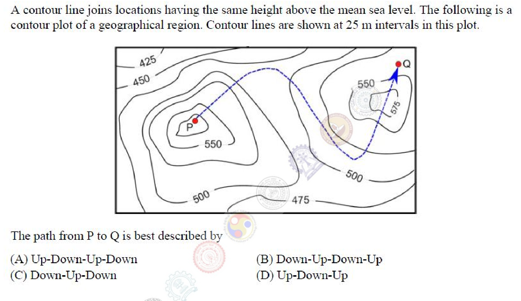
A contour line joins locations having the same height above the mean sea level. The following is a contour plot of a geographical region. Contour lines are shown at 25 m intervals in this plot.
[Figure: A contour map with a hill labelled P on the left, a second hill labelled Q on the right with contour values up to 575 m, and a lower area marked 475 and 500 between them. A dashed path leads from P to Q.]
The path from P to Q is best described by
Practise this question in The GATE Grind →
Show answer and explanation
Correct answer: (B) Down-Up-Down-Up
Explanation
P is on top of a hill, so the path must first go down. It then crosses a ridge between the hills, which is a rise, then drops into the low area marked about 475 to 500 m, and finally climbs the second hill to Q. That sequence is Down, Up, Down, Up.