GATE 2017 EE – Question 10
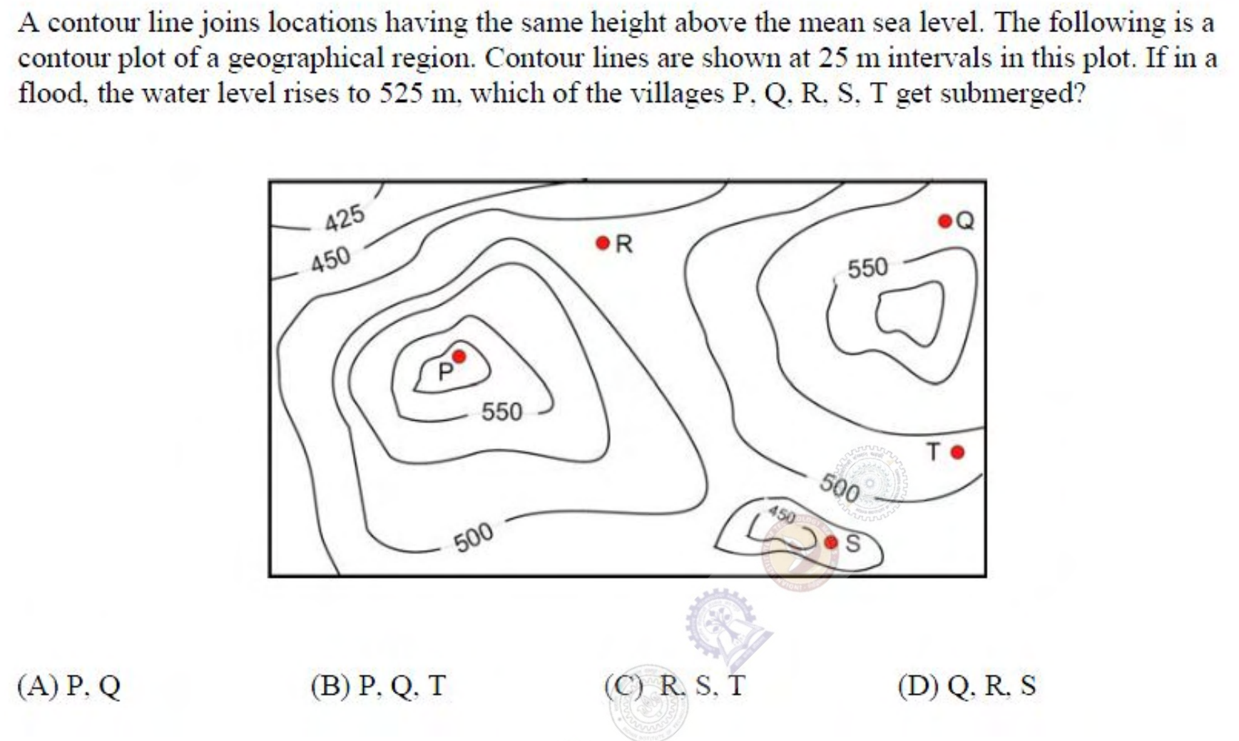
A contour line joins locations having the same height above the mean sea level. The following is a contour plot of a geographical region. Contour lines are shown at 25 m intervals in this plot. If in a flood, the water level rises to 525 m, which of the villages P, Q, R, S, T get submerged?
Practise this question in The GATE Grind →
Show answer and explanation
Correct answer: (C) R, S, T
Explanation
Water at 525 m covers every place below 525 m. Village P sits on a hilltop inside the 550 m contour, so it stays dry. Villages R, S and T are in lower ground, below the 525 m level, so they are submerged.